Battelle Darby Creek Metro Park
Essential Information
- Mileage: 17 miles
- Activities:
- Running
- Trail Running
- Biking
- Location: SW Franklin County
Battelle Darby Creek is the largest park in the Metro Park system. There are a great variety of trails here, and a wide range of different landscapes. It’s the only place in Central Ohio where you can put in a large number of running miles off road.
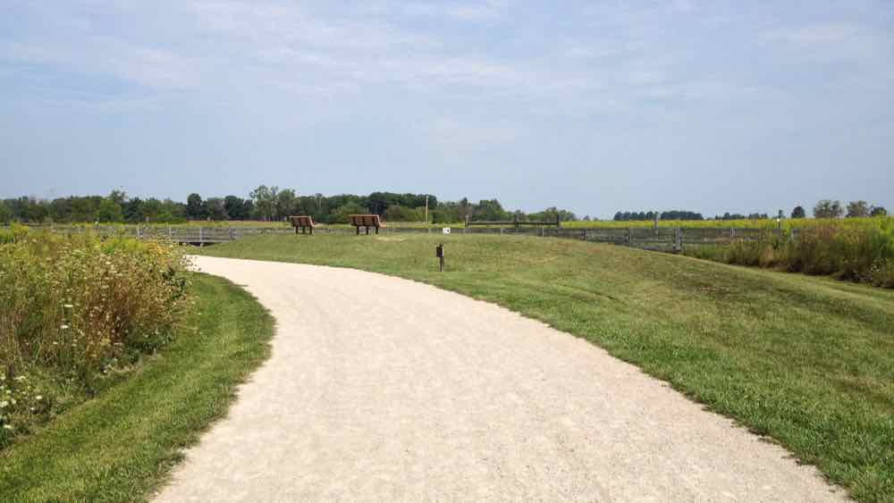
The Darby Creek Greenway Trail is likely the most used trail in the park. The park has a herd of bison that are sometimes visible from the trail, although they never seem to be out when I’m there. The 5 mile trail is wide, flat, and dirt road like, and it winds through prairie and fields. It is quite scenic, but not challenging or remote. The surface is excellent for running. Unlike all of the other trails in the park, trail running shoes are not needed on this section. I frequently used this trail when training for a marathon because it gave my feet a break from the road but still allowed me to keep my running speed high. The trail is open to both runners and cyclists. That said, the trail is a bit short to be a cycling destination on its own. However, if you are already going through the park on the Camp Chase Trail, it’s definitely worth a detour. Although I can’t say for certain, I suspect that the trail would handle wet weather much better than anything else in the area.
The 3 mile Dyer Mill Trail was clearly built with cross country skiing in mind. The trail is fairly wide and mostly clear of overhanging trees. Going clockwise from the parking lot, the first half is mostly dirt doubletrack, and the second half is mostly grass and closer to the width of a small road. The trail is mostly flat, but there are several short and steep hills. The trail is closed to hiking and running when there is enough snow for cross country skiing. The trail is enjoyable enough, but with so many other trails in the park it’s probably not the first place to try.
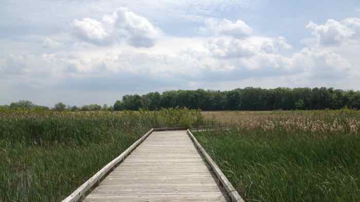
The Teal, Harrier, and Railway trails have different names, but they are really one 3 mile loop that goes through prairie and wetlands. This is probably my least favorite section in the park. The trail has a very uneven and bumpy grass surface that is unpleasant for running. The trail is completely flat, and will likely be muddy if it has been wet. The scenery is nice, but it is not any different than the Greenway trail, which has a much nicer surface and is right across the street. Despite being my least favorite, it’s still worth running if you’re trying to add miles and not repeat trails.
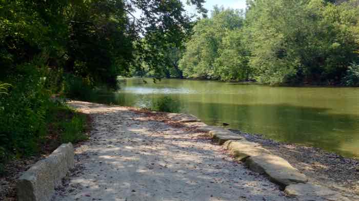
There are two groupings of trails in the park’s southern section that provide the most challenging and rugged trails. These trails are best accessed from the Alkire Rd. parking lot rather than the main parking lot. One 2 mile grouping consists of the Indian Ridge, Cobshell, Hawthorn trails. On the trail it’s not entirely obvious where one begins and the other ends, but as they are all short sections it’s hard to get lost for too long. These trails are the hilliest and must challenging in the park. The trails are narrow, wooded, and frequently steep. The second grouping consists of the Ancient and Terrace trails. They are two connected trails that can be combined to form a nice 4 mile loop. These trails are similar to, but slightly less challenging than, the Indian Ridge, Cobshell, and Hawthorn trails. Portions of both trail groupings go alongside the Big Darby Creek.
Additional Information
- View the Darby Creek trail map on the Metro Park’s website.
- View the park’s location on Google Maps.
- The Darby Creek Greenway Trail is the only trail in the park open to cyclists. However, the 12 mile Camp Chase Trail travels through the park and is open to bikes. It can be accessed from the Alkire Rd. parking lot. I have not yet used this trail, but I will ride it and add info soon.