Heritage Rail Trail
Essential Information
- Mileage: 6 miles
- Activities:
- Running
- Biking
- Location: Hilliard
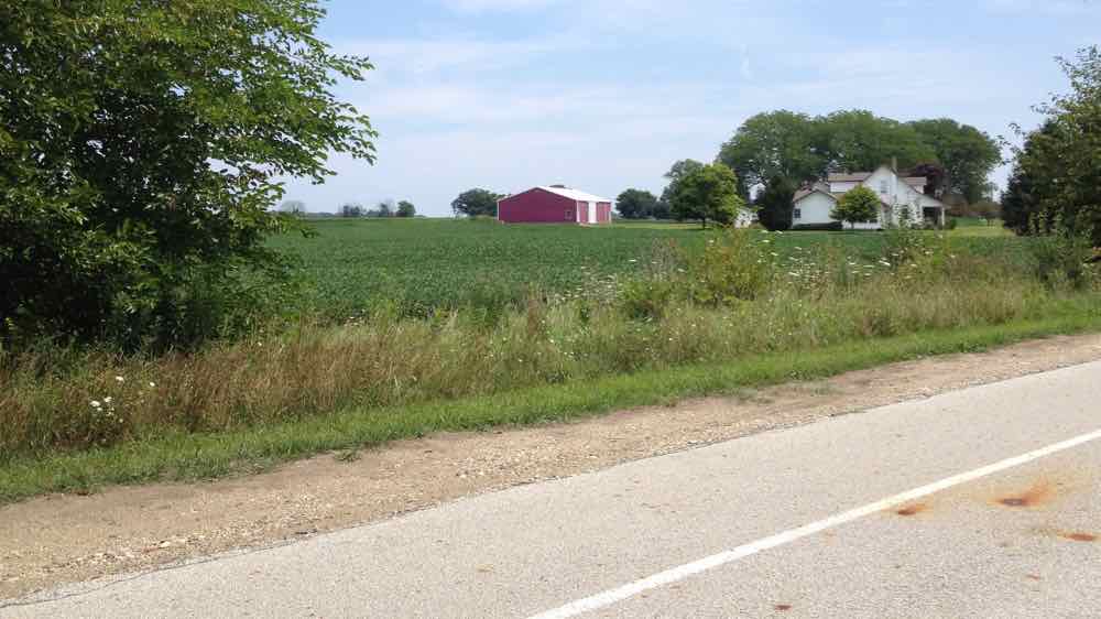
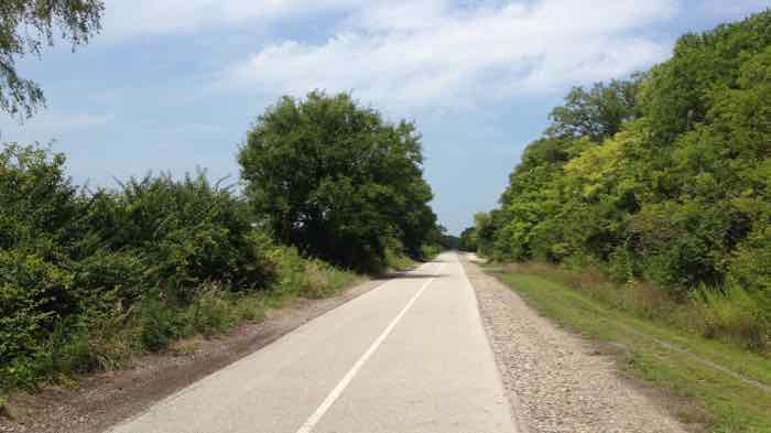
The Heritage Rail Trail is a six mile paved trail that starts in downtown Old Hilliard and quickly transitions to the country. The trail is completely flat, and after briefly passing through suburban neighborhoods and a city park, it is mostly surrounded by scenic meadows and farmland.
This is an incredibly easy trail to follow. Other than a few obvious side trails leading into the surrounding neighborhood, it is nearly impossible to get lost. It’s still important to pay attention through, because there are several busy road crossings that can easily sneak up on you. Cars do not stop at the crossings, so pay careful attention.
About a mile from the trailhead the trail passes Homestead Park. The park is the only place on the trail with water and restrooms, both located near the blue train car, which is visible from the trail. The park is also one of two places to park. The other is at the southern trailhead, located on Center Rd. just north of Main St.
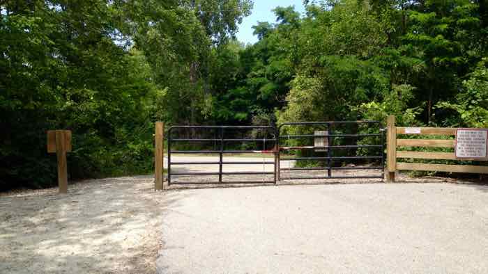
In addition to being enjoyable on its own, the Heritage Rail Trail serves as a great way to access the many road cycling opportunities in the Plain City area. You can easily bike around the gate blocking the end of the trail in order to access Cemetery Pike Rd. From here, the roads in this section of town are scenic, well maintained, and relatively uncrowded, and they are well worth exploring.
It is also worth noting that there is a 5 mile trail accessible from the Heritage Trail. Different sources and signs give this trail different names, including Hellbranch, Vaniard, and Mudsock. I don’t have a stand alone page for this trail because although it is fully rideable, it still feels a bit incomplete. There are few trail markings, and it can be very difficult to follow as the trail frequently intersects with other neighborhood and park trails, paths, and sidewalks. I had to stop numerous times to find my way. That said, if you don’t mind needing to make an effort to navigate, the trail itself has some nice sections and is worth trying. It is mostly paved, but about 1.5 miles near the end is packed dirt and crushed stone. To find this trail, look for the Vaniard Trail sign at mile marker number 1 on the Heritage Trail.
Additional Information
- View the Heritage Rail Trail map on the Heritage Rail Trail’s website.
- Find additional info about Homestead Park on the Metro Park’s website.
- View the trail location on Google Maps.
- I haven’t found a stand alone map for the Vaniard/Hellbranch/Mudsock trail, but by going to the Central Ohio Greenways’ online interactive map and clicking on the Hellbranch option you can get a useable map. Be sure to carry a phone with this site loaded in order to find your way, or else you will likely get lost.