Olentangy Trail
Essential Information
- Mileage: 14 miles
- Activities:
- Running
- Trail Running
- Biking
- Location: Near Rte. 315
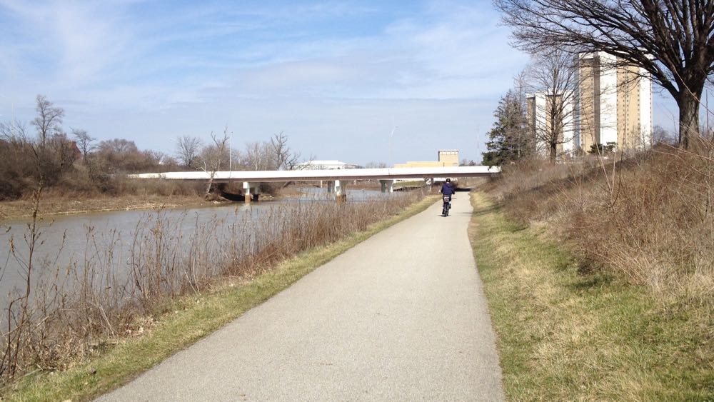
If there is one trail that displays the full range of Columbus scenery and terrain, it’s the the Olentangy Trail. Spanning over half the distance of Franklin County, this paved trail follows Route 315 and the Olentangy River as it travels from downtown, past Ohio State, all the way up to southern edge of Deleware County.
Although it is one continuous trail, the northern and southern sections have very distinct feels. The northern section is quieter and suburban, going through the edges of Worthington and Clintonville. It’s not remote, but sections can feel removed from the city. I occasionally see deer on this section of trail. The southern section of the trail is more urban, traveling along the edge of Ohio State, Harrison West, and Downtown. It’s only a short hop off the trail to access campus or the shops of the Short North. The trail here always feels close to the city, with many portions traveling close to 315 and other major roads.
While the scenery differs between sections, the trail itself is similar. The trail is entirely paved, and it is well maintained. It is generally flat, and there are no major climbs along the entire route. Both sections of the trail can get very crowded on weekends when the weather is good. This is not a big problem if you are running, but faster cyclists will find the need to constantly pass people annoying.
There are two mildly confusing aspects to the trail. First, many small unmarked trails frequently intersect with the main trail. These trails provide access to the surrounding neighborhoods and parks. Thankfully, these side trails are short, and if you accidentally stray onto one, you will find out quickly and can easily turn back around. The second confusing point is at the southern terminus of the trail. The trail ends when it hits Long Street near downtown. However, the Scioto Trail continues on the other side of the road, so it’s not immediately obvious that trail ends here. Continuing on the Scioto Trail can make for a great addition, but it’s important to pay attention here or else you might unintentionally add 9 miles to your trip.
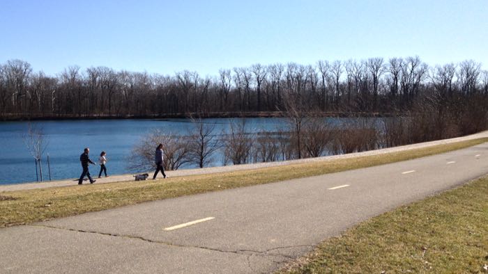
There are several off pavement options on the northern section. A one mile dirt trail branches off from the paved trail and travels around Antrim Lake. The surface is pleasant for running, and the trail offers great views of the lake. This section is closed to bikes. There are also several unofficial dirt trails that occasionally run alongside the paved trail in the northern section. These trails don’t offer a true trail running experience, but it’s possible to spend a decent amount of time off pavement by linking together these sections and by using the Antrim Lake trail.
Additional Information
- View the Olentangy Trail map on the Columbus Parks and Rec website.