Sharon Woods Metro Park
Essential Information
- Mileage: 7 miles
- Activities:
- Running
- Trail Running
- Location: Westerville
Sharon Woods is much more closely surrounded by the city than most of the other Metro Parks. Yet somehow it still feels surprisingly wild and set apart from the nearby traffic. The picnic areas and playgrounds are heavily used, but the trails are surprisingly uncrowded.
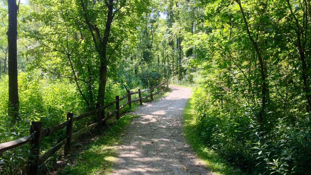
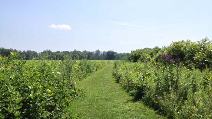
Sharon Woods has four short unpaved trails, but they can easily be combined into one longer loop of about three miles. The easiest way to make a loop is to start on the Edward S. Thomas Trail, which is located across the road from the playground in the Schrock Lake picnic area. This trail traverses wooded land and it is primarily a wide, hard-packed dirt surface over flat terrain. The short Oak Openings spur trail is essentially the same trail, and it adds a tiny bit of additional distance. Look for the connector trail on the left. This will lead to the Spring Creek Trail. The Connector Trail and the first section of the Spring Creek Trail are flat grass trails that wind through a meadow. Take a left when the Connector Trails hits the Spring Creek trail. This trail will quickly leave the meadow and return to the woods. Unlike the other sections, this trail here is hillier, and the surface is mixed hard-packed dirt and pebbles. Towards the end of the trail there are several options, but the easiest is to continue on the trail until it loops back to the Connector trail and then finish the final section of the Edward S. Thomas Trail, which ends just a few hundred feet from the start.
The trails are well marked, and there are many maps and markers placed along the trail. The only real source of confusion is near the end of the Spring Creek Trail, where several unmapped trails lead away from the main trail and towards the picnic areas. Even after running the trail many times I still occasionally take a wrong turn on one of these unofficial trails. If this happens, just look for the main park road and follow it back to the parking lot.
The 3.8 mile Multipurpose Trail is a paved trail open to runners and cyclists, but it’s too short to be worth traveling here just to bike. The trail goes through a mix of woods and meadows, and it contains a few small hills. There is a somewhat uncommon setup on the trail. Cyclists must ride counterclockwise on the right side of the trail, and walkers and runners can go in either direction but must stay on the left side. The trail is well marked to remind users of this, but since this is relatively uncommon it seems worth mentioning. There are water fountains on the trail. There are no real exits on the trail. Once you start the loop you either need to complete it or turn back.
Additional Information
- View the Sharon Woods trail map on the Metro Park’s website.
- View the park’s location on Google Maps.